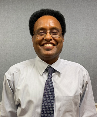
DR. KHALID HUSSEIN
Department of Geography and Urban Sustainability, College of Humanities and Social Studies (CHSS), UAEU
- Group:Exploring Land use land cover change and Flooding Risks using Remote Sensing and GIS Techniques
DR. KHALID HUSSEIN
Department of Geography and Urban Sustainability, College of Humanities and Social Studies (CHSS), UAEU
Dr. Khalid Hussein joined the Department of Geography and Urban Sustainability, College of Humanities and Social Studies (CHSS), UAEU in 2015. Prior to that Khalid taught and conducted research at the University of Colorado, Boulder. Khalid competed his graduate and postgraduate studies at the University of Georgia Augusta, Goettingen, Germany, and the University of Colorado, Boulder, USA. Khalid research interests are in the use of geographic information systems (GIS) and satellite and airborne remote sensing techniques, integrated with in situ observations and modeling, to understand how and why the Earth cover is changing, and what those changes mean for life on Earth. Khalid research focuses on three areas. The first is the use of remote sensing techniques integrated with GIS, and in situ data to understand how and why land cover and land use are changing; and what those changes mean for sustainability of natural resources. The second research area focuses on the understanding of the effects of climate change on the Earth’s surfaces using remotely sensed data and field measurements. Finally, he is also interested on the application of thermal remote sensing in identifying and delineating areas of geothermal activities as a potential source of energy.
