

Open-Source GeoAI for Earth Observation: Practical Tools for AI-Driven Analysis and Visualization
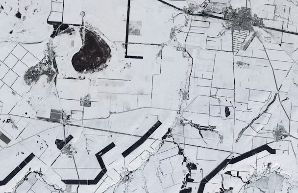
The rapid expansion of Earth observation data from satellites, aerial platforms, and cloud-based archives has created unprecedented opportunities for large-scale environmental monitoring and analysis. At the same time, the volume, complexity, and velocity of these data demand new approaches that are both scalable and accessible. This presentation focuses on open-source GeoAI tools designed specifically for Earth observation applications, highlighting how artificial intelligence can be integrated with geospatial data science to enable efficient, reproducible, and transparent workflows. The talk introduces the GeoAI Python package and its ecosystem, which support a wide range of Earth observation tasks, including land cover classification, object detection, semantic segmentation, and change detection. Through real-world examples, participants will see how open-source tools can streamline data access, model development, and interactive visualization. The integration with QGIS and web-based mapping frameworks further enables seamless analysis across desktop, cloud, and browser environments.
Dr. Qiusheng Wu
Associate Professor at University of Tennessee
Dr. Qiusheng Wu is an Associate Professor in the Department of Geography & Sustainability at the University of Tennessee, Knoxville, and an Amazon Scholar. His research focuses on open-source geospatial data science, cloud computing, and GeoAI for Earth observation. He is the creator and maintainer of widely used open-source Python packages, including Geemap, Leafmap, SamGeo, and GeoAI, which enable scalable analysis and visualization of satellite and geospatial data. His work emphasizes building accessible, reproducible tools that bridge artificial intelligence and Earth observation.