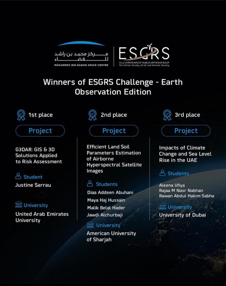
The Emirati Society of GIS and Remote Sensing, in collaboration with the Mohammed bin Rashid Space Centre (MBRSC), is thrilled to invite university students passionate about GIS, Remote Sensing, and the Environment, to join the ESGRS Challenge - Earth Observation Edition.
This challenge aims to encourage students to apply their expertise in GIS and Remote Sensing applications to explore new frontiers and address real-world challenges. By harnessing the power of spatial data and advanced technologies, participants will develop innovative solutions that have the potential to make a positive impact on possible environmental solutions in order to serve the humanity and earth.
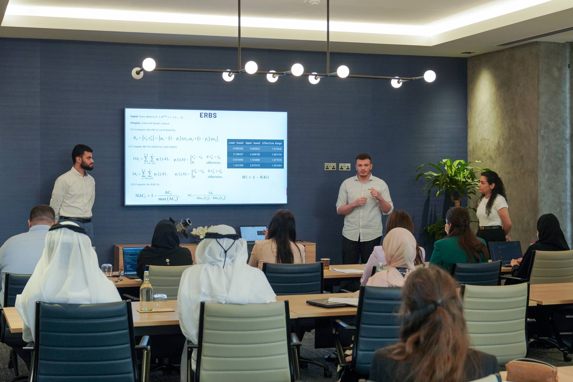
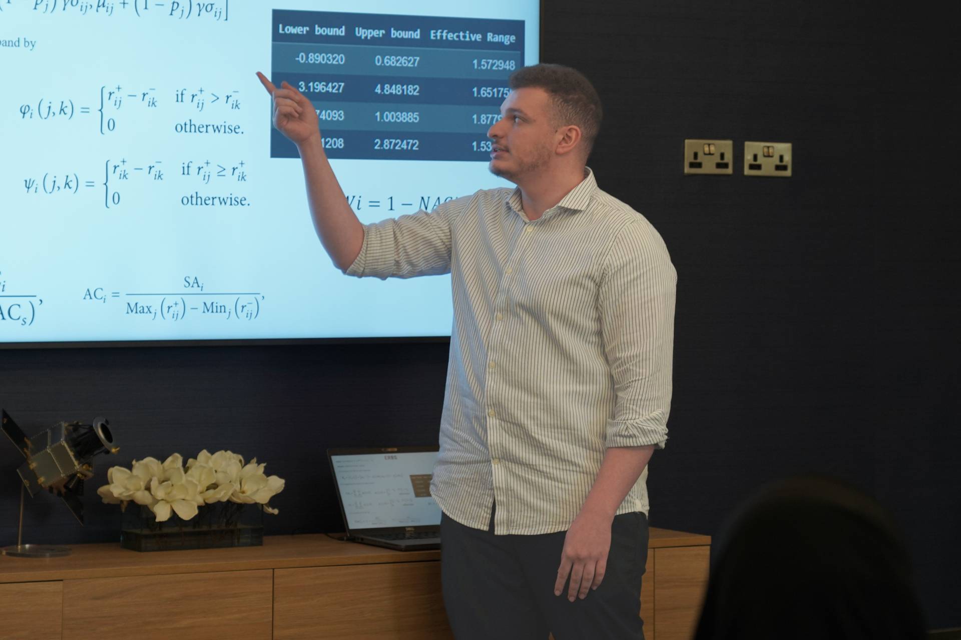
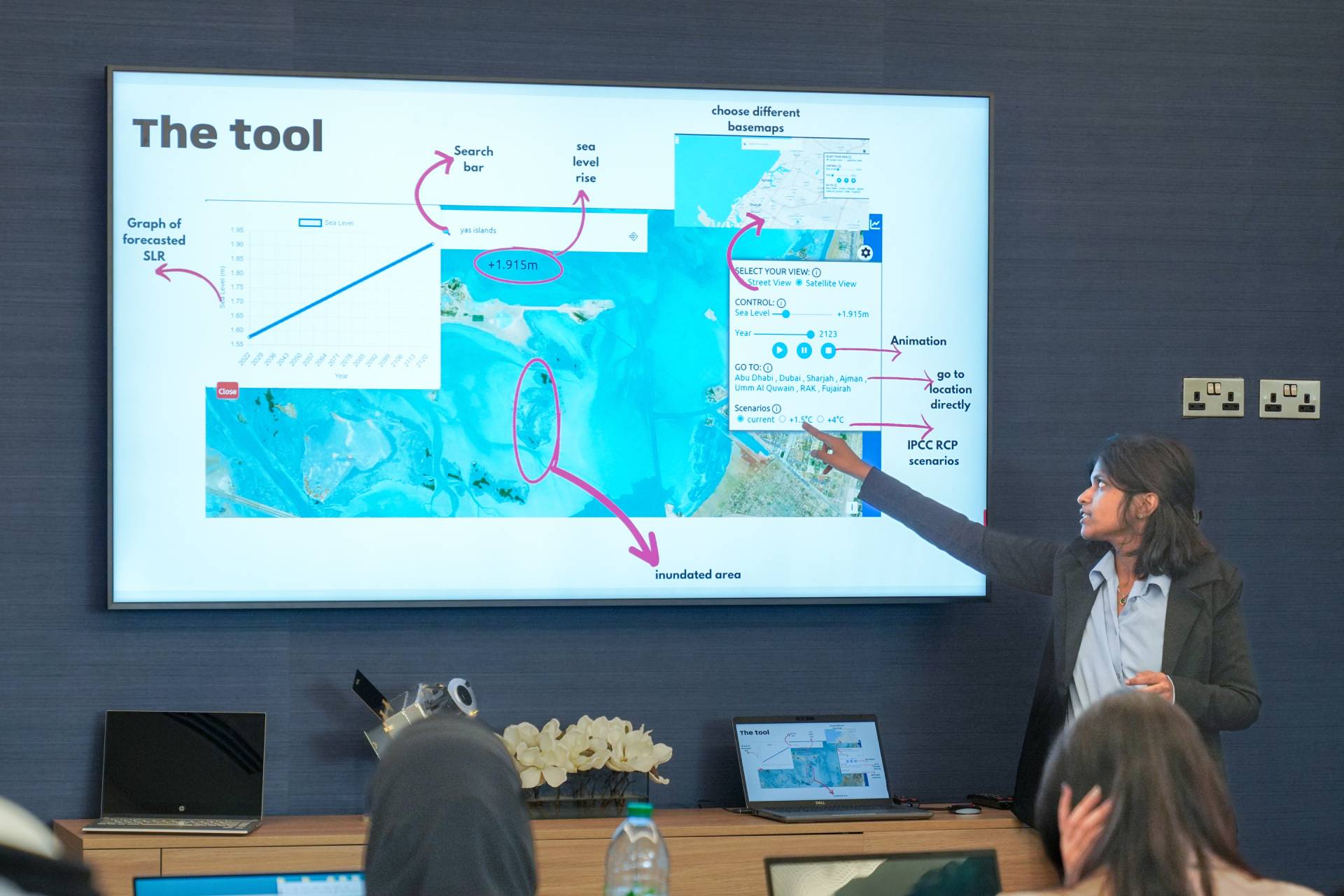
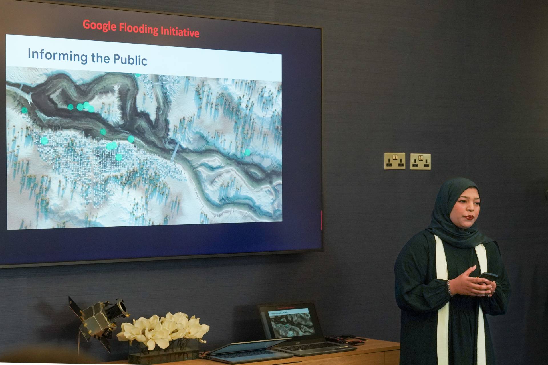
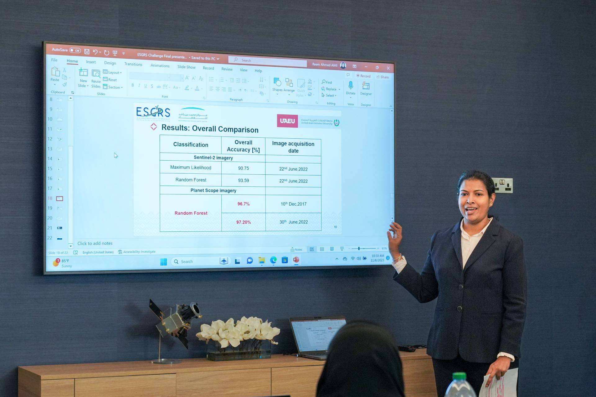
The Challenge is to come up with a GIS analysis method (Tool, Algorithm, Simulation, Interface, Automated Process) that can be used to support environmental real-world cases, such as natural disaster response, flood mapping, sea-level rise, coastline monitoring, greenhouse gas emissions, air quality, water quality, vegetation analysis, corps monitoring and any topic which can improve the humans' practices towards our Earth!