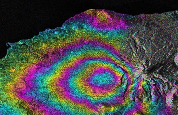
Operational Satellite Radar Interferometry (InSAR) Applications for Earthquake and Ground Deformation Monitoring
Earthquake-induced ground deformation and slow-moving geohazards such as subsidence and landslides pose significant risks across tectonically active and rapidly urbanizing regions. Through real case studies, the session will demonstrate how multi-temporal